
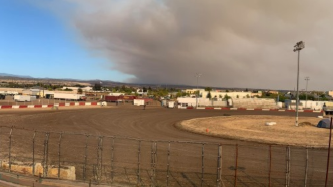
A cloud of smoke grew enormous on Butte County’s eastern horizon Sunday afternoon (Sept. 27) as high northeasterly winds predicted for the day fanned the flames of the North Complex Fire and stoked a new fire near Redding.
In an update this morning (Sept. 28) , Cal Fire spokesperson Shane Lauderdale explained that, in the West Zone of the North Complex Fire, “everything stayed within the control lines through this incredible wind incident we just went through.” That area would be on the southeastern side of the fire’s perimeter near the border of Butte and Yuba counties.
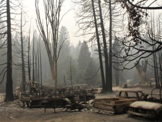
In the North Zone of the fire, however, spot fires broke out beyond the containment perimeter in the area of Bucks Lake in Plumas County. According to the U.S. Forest Service, wind gusts of 30-40 mph drove flames southwest toward Butte County, along the edge of the Camp Fire burn scar parallel to Highway 70 and east of Feather River Canyon. As a result, the Butte County Sheriff’s office issued an evacuation order for areas to the west of the highway—Pulga, Concow, Big Bend and Yankee Hill—and evacuation warnings for Sterling City and Magalia and much of Paradise (between Clark Road and Lake Oroville from town limits north and south). On top of that, the Town of Paradise issued an evacuation warning for all of Paradise.
The fire did not cross to the west side of Highway 70, and today Cal Fire will be returning to engage contingency lines already in place in the area.
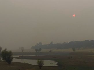
A red flag warning from the National Weather Service remains in effect until 9 p.m. today when the forecast calls for winds to die down. Additionally, power is expected to be restored some time this evening to the above regions impacted by the current PG&E Public Safety Power Shutoff.
The newly burned area is still being assessed, and containment numbers haven’t been changed since yesterday—78 percent and 306,135 acres burned for entire North Complex; 88 percent and 84,595 acres for West Zone portion.
Meanwhile, around 4 p.m. Sunday, the Zogg Fire ignited in Igo. As of this morning, it had burned 15,000 acres and evacuations extended from the Shasta County area to the Tehama County line, according to Cal Fire.
For the latest evacuation information on the North Complex Fire, visit the Butte County Sheriff’s Office website, check out the updated evacuation map or call 833-512-5378.
Also, visit the Chico News & Review’s new Wildfire Resources page for updates and links to current information on fires, evacuations, weather, air quality, shelters, recovery assistance and more.

Be the first to comment