
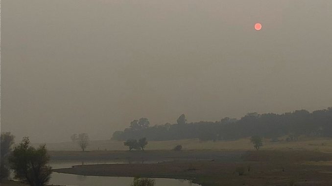
Due to millions of acres of wildfires burning in California, Oregon and Washington, the West Coast states had the worst air quality in the world this past weekend. Saturday and Sunday (Sept. 12-13) Chico’s air quality index (AQI) ranged from 171 to 722 according to airnow.gov—the official U.S. air quality website—a pattern that was consistent with readings in San Francisco, Medford, Portland and Seattle.
In Oroville, on the edge of the North Complex Fire’s West Zone, there were AQI readings of well over 1,000 both Saturday and Sunday mornings. A value between 151 and 200 signifies “unhealthy” conditions; 201-250 is “very unhealthy;” and anything 301 and above is “hazardous” air quality.
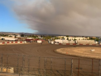
The weekend’s smoke hampered Cal Fire’s air operations, but the cover provided cooler and more humid conditions for firefighters on the ground, and slowed growth of the West Zone to just under 4,000 acres from Friday night (Sept. 11) to this morning (Sept. 14) and increased containment from 5 to 20 percent. The West Zone is now at 74,000 acres burned. The entire North Complex is at 264,374 acres and 38 percent containment.
However, increased southwest winds that could bring gusts up to 35 miles per hour to the fire area have officials concerned that fire activity could pick up today, and a red flag warning has been issued through 8 p.m. tonight (Sept. 14) in the eastern half of Butte County.
The North Complex Fire entered Butte County on Sept. 8—creating what is now referred to as the West Zone—and since then 14 people have died in that area of the fire. Butte County Sheriff Kory Honea announced at the Sunday night fire-information news conference that three of the deceased have been positively identified: Khawar Batti, age 58; Millicent Catarancuic, age 77; and Josiah Williams, age 16—all of Berry Creek.
Damage assessment is still in progress, but the current number of destroyed structures (homes, businesses and other) is at 536, with an additional 40 damaged. Cal Fire has created an interactive online damage-inspection map that is updated regularly with the status of structures within the North Complex burn area.
The Sheriff’s office has lifted the evacuation warnings for most areas of Oroville, and many evacuation orders have been downgraded to warnings—Forbestown Road from Hwy 162 to Lumpkin Road; all roads north of Forbestown Road including Lake Haven Way and Faye Mar Drive; Bangor area from Forbestown Road south to Swedes Flat Road; East of Miners Ranch Road to the county line.
In response to today’s red flag warning, however, an additional evacuation warning has been issued for the area west of Table Mountain to Highway 70 north of Garden Drive and the water canal.
For the latest evacuation information, visit the Butte County Sheriff’s Office website or call the Fire Information Line at 538-7826.
Also, visit the Chico News & Review’s new Wildfire Resources page for updates and links to current information on fires, evacuations, weather, air quality, shelters, recovery assistance and more.

Be the first to comment