
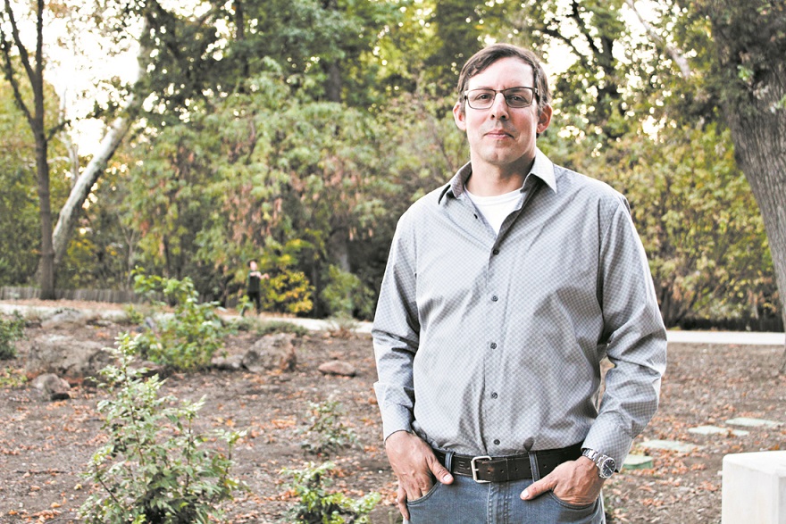
Don Hankins respects fire. For the better part of two decades, as a graduate student as UC Davis and professor at Chico State, he’s studied how wildfires burn and move. He knows their patterns, their behavior—and changes to both in recent years.
He also understands the dread of fire season. Hankins lives in Forest Ranch, among Butte County’s communities in the wildland-urban interface. The day of the Camp Fire in 2018, instead of delivering a scheduled talk on fire ecology at the Chico Creek Nature Center, he evacuated his home. This September, Hankins monitored the North Complex Fire with similar anticipation.
“We’ve packed up several times and kind of left things packed up and moved out of the area several times for this part of the season,” Hankins said by phone last month. “And I know I’m not the only one—I’ve talked to people I know in Magalia who’ve done the exact same thing.
“It’s not exactly the best way to live, being like that. But until we get a handle on things, we know we can’t trust that our forests aren’t going to burn down around us.”
Indeed, besides the coronavirus pandemic, wildfires have defined 2020 in California. Cal Fire reports, as of Nov. 2, a tally of 8,834 fires—burning 4.15 million acres, killing 31 people and destroying or damaging 10,488 structures. Some 4,400 firefighters were battling 23 active fires across the state and responded to 28 new ones that day alone.
“The forecast for November predicts warmer and drier than average weather across much of California,” Cal Fire advised on its Daily Wildfire Report online (fire.ca.gov). “Many areas in Northern California, as well as the Southern Coast and Los Angeles Basin, will remain at an above normal potential for significant fire.”
This year’s fire activity already has surpassed historic marks. The total more than doubles the previous high in records dating to 1987; the August Complex Fire, which scorched five counties northwest of Butte, is the largest in state history with more than 1 million acres burned. The North Complex Fire ranks No. 6 at nearly 319,000 acres.
In fact, the seven biggest wildfires in state history have come since December 2017. The Camp Fire of Nov. 8, 2018—California’s deadliest—does not rank among the top 20 in size even though it leveled the town of Paradise among 153,000 acres of devastation.
Amid the statewide smoke of summer and autumn, debate on fire prevention flared publicly, breaking largely along political lines. The apex moment came Sept. 14, when President Trump and Gov. Gavin Newsom met for a briefing in Sacramento and laid out their divergent views: Trump pointing (vaguely) to forest management, Newsom to climate change.
Hankins sees validity in both perspectives. So do other experts in the field, including botanist Wolfy Rougle, forest health watershed coordinator with the Butte County Resource Conservation District, and pyrogeographer Zeke Lunder, a Chico-based mapper and analyst of wildfire for Deer Creek Resources. They agree that only a comprehensive approach will address the issue—and prevention measures must take into account California’s long history by drawing on practices from this country’s first wildland inhabitants, Native American tribes.
“It’s not an either-or debate,” Rougle said. “Climate change is happening, and it’s exacerbating the effects of our forest management. If we’d been managing our forests perfectly this whole time, we’d still be contending with some fallout from climate change; and if we still had the climate of the 1700s but we’d been suppressing fire [as we have] for the past century, we’d still have a lot of problems here in California.”
Among the biggest challenges is overgrowth—of both vegetation and civilization. Accumulated underbrush and flammable trees make for tinderbox conditions on hot, dry, windy days. Lightning strikes, human ignitors and, increasingly, aging electrical infrastructure create the sparks. Meanwhile, Californians have developed communities in deep wooded areas, with increasingly tragic results.
“The scale of the [woodland-urban interface] problem exceeds our ability to manage it,” Lunder said. “We will never be able to cut enough brush and trees to keep all the poorly planned foothill and forest communities safe from the accelerating wildfires. …
“All the money in the world can’t save these places when the winds howl.”
Critical conditions
Though wildfires have intensified the past few years, the upward trend started earlier. Scientists tracking data over the past 40 years found fire season globally increased by eight days from 1979 to 2019. Additionally, there were eight times more fires on average in California during the summer between 1972 and 2018, and in western U.S. forests, 10 times more land burned annually in 2003–2012 versus 1973–1982.
Researchers for ScienceBrief Review culled that information and more from 116 studies for a report, released Sept. 25, titled Climate Change Increases the Risk of Wildfires. They concluded that “land management alone cannot explain recent increases in wildfire because increased fire weather from climate change amplifies fire risk where fuels remain available.”
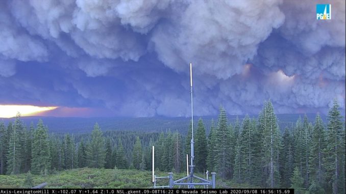
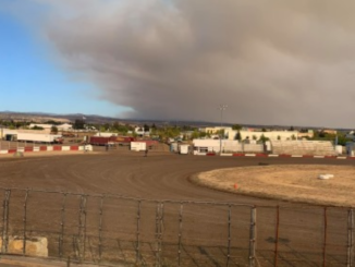
Wildfires are behaving differently, too. Blazes travel at unprecedented speed, such as how the Camp Fire whipped through Paradise at around 100 mph—at points spreading faster than 275 mph. The recent Bear Fire, renamed when incorporated into the North Complex Fire, burned a swath 30 miles by 25 miles—in the process leveling the community of Berry Creek—over the course of 24 hours, Sept. 8-9.
“People ask me, ‘Are you surprised by what you’re seeing?’” Hankins said. “Well, I am because I haven’t experienced this before, but it’s to be expected that it’s going to happen.”
Most people know the “fire triangle” of fuel, oxygen and heat, “which give you the ability for a fire ignition to happen,” he explained. A spark hitting wood or vegetation, with the right dry air or wind, produces wildfire. The Camp Fire traces to faulty PG&E wiring near Pulga, the North Complex to a lightning storm over the Plumas National Forest.
A second triangle shapes wildfire behavior: fuel, weather and topography.
“I would say half of [the North Complex area] hadn’t had fire on it in the last mapped fire histories, going back 120 years,” Hankins continued. “You’ve got a lot of accumulation of fuels, the topography [of mountain forests], and then you’ve got the weather—and the wind and those drought conditions are the big factors feeding into it.”
Rougle got a bird’s-eye reminder of the topography recently when she stood on the summit of Humboldt Peak at the northeastern border of Butte County. Surveying the Lassen National Forest, she saw a “vast, unbroken canopy of dark conifers across the landscape, as far as you could see, until you hit a rock.
“You should be able to see a lot more light hitting the forest floor,” she said. “A hawk flying over the Sierra Nevada should be able to see the ground a lot more. But she can’t today.”
On her drive to the summit, Rougle saw a healthy copse of black oaks in a burn scar. Historically, she said, these ranges probably held more hardwood trees such as oaks than conifers such as pines.
“The overdensity and the overdominance of conifers relative to the historical forest is a result of fire suppression,” she added. “If you want more hardwoods in the mix, you allow fires to burn.”
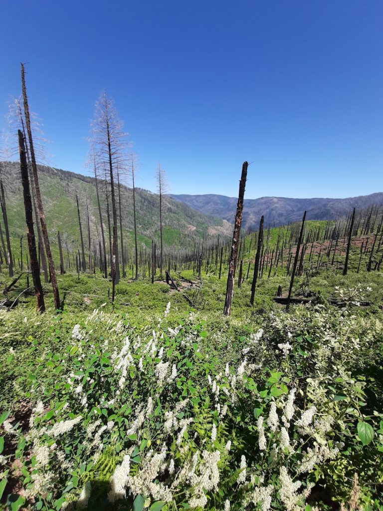
Camp Fire burned at “stand-replacing intensities”—meaning
nearly all conifers were killed at once. (Photo courtesy of
Wolfy Rougle)
California’s forests widely have been described as “tinderboxes” due to the preponderance of flammable tree species, tightly packed, with loose materials strewn on the floor. As Lunder points out, another hot zone is our foothills—one of “the most productive places in the world to grow brush and trees.”
Fighting fire with fire
Seated with Newsom in September, Trump—as he has done on other occasions—blamed California leaders for the wildfires. The president decried the state’s forestry practices (though Newsom countered that 57 percent of the state is federal land, with just 3 percent of forests state-owned). The governor acknowledged that Trump made a commitment to fund prevention measures such as the removal of underbrush—what the president imprecisely called “raking” forest floors when he and Newsom, along with then-Gov. Jerry Brown, visited Paradise 10 days after the Camp Fire—but couldn’t get Trump’s concurrence on climate impacts.
Many people hear the term “forest management” and immediately think of logging. Timber-harvesting is one component, but the tableau is more expansive. The U.S. Forest Service defines the term as “focus[ing] on managing vegetation, restoring ecosystems, reducing hazards and maintaining forest health to include the ecology as a whole.”
Hankins, as a fire scientist hearing the debate play out, takes a similarly holistic view.
“Climate change is a factor that certain people, for some reason, don’t want to recognize … and we do need to be paying attention to it. But at the same time, we do need to recognize that our way of stewarding the land, or managing the land, hasn’t been effective, either,” he said.
“We, particularly in our forested ecosystems in the state, have over the last 120 years sought to increase the number of trees in the forest at a time when the climate is shifting to a warmer situation. When you have that warmer situation with more trees, you have a greater risk of drought stress on those trees, disease outbreaks, those kind of things, that combine to make the recipe for what we’re getting now—and that is the correction factor of having fire back in the landscape.”
By “back,” Hankins references the 19th century and earlier when Native Americans were the proverbial land managers of California. Those include Chico’s Mechoopda Indians, but also ancestors of Hankins’ in the Osage and Me-Wuk tribes.
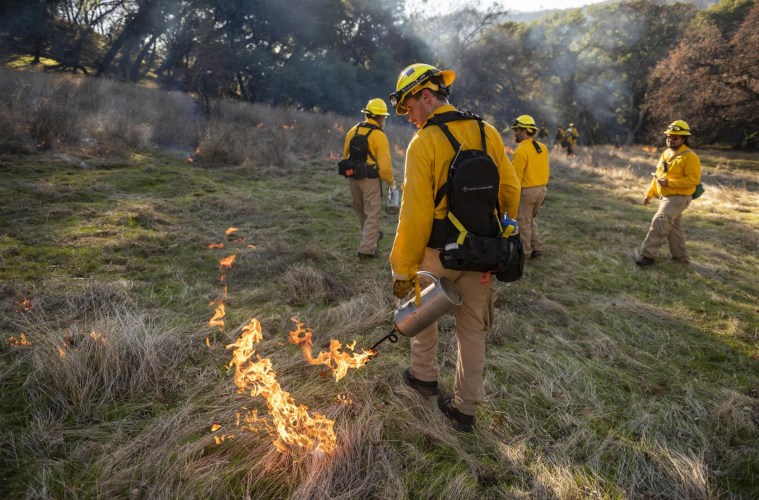
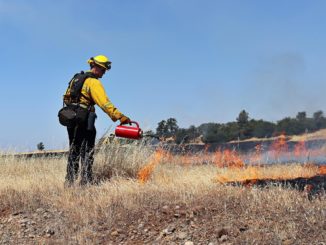
Indigenous people long have used prescribed burning to augment vegetation fires that occur naturally from lightning strikes. Hankins has studied these practices extensively, taught them widely—including to firefighters in Australia—and for 13 years has utilized controlled burns to manage Chico State’s ecological reserves. (See “Feet to the fire,” CN&R, Dec. 6, 2018.)
“That’s how a lot of those fine fuels were traditionally managed, going way back into indigenous times,” Hankins said—this intentional burning combined with gathering tree limbs for firewood and, to a certain extent, animals grazing. “In today’s context, very few people are picking up branches and using them in that way,” he added, and public aversion to fire has steered prevention policy away from prescribed burns.
“So in the course of a 10-year time period, you end up with a lot of material that’s on the ground,” Hankins continued, “and while you have some decomposition that occurs and you need to have a little bit of organic material to cover the soil, the rate at which it’s accumulating is faster than the rate of decomposition in these areas.
“You have to have some process of removing it—and fire is the natural tool to do that.”
Current conditions make controlled burning difficult, though, as those 10-year periods have multiplied—tenfold in some spots, such as remote Sierra Nevada lands. Monumental brush-clearing operations would need to precede such burns.
Moreover, 20th century priorities shifted the paradigm to fire suppression. According to Pro Publica’s recent California Burning series, scientists estimate that between 4 million and 12 million acres of California forests burned in prehistoric times. In the past four decades, state agencies have only applied prescribed burning to a tiny fraction of open lands—an average of 30,000 acres a year from 1982 to 1998 and 13,000 a year from 1999 to 2017. A February 2020 study published in Nature Sustainability found the state would need to burn 20 million acres to re-balance.
Indigenous tribes used fire with broader intentions, Rougle said: to make acorns bigger, beargrass stronger, greens sweeter, redbud straighter. Over time, the local ecosystems adapted to these applications and even “came to rely on the right kind of fire at the right time.” That time frame, late summer and early fall in most of the state, has turned into our red flag season.
Nowadays, Rougle added, “agencies are realizing the importance of fire, but most agencies’ primary goal is just fuel reduction. … Reviving Native burn traditions that are good for the land could require rethinking fire season and allowing more flexibility in how burns are permitted.
“Of course, this requires greatly increasing the number of fire practitioners we have, because right now there aren’t enough trained folks in the state to both fight the bad fires and light the good ones at the same time in different ends of our 700-mile-long [state].”
No end in sight?
Lunder, who has worked prescribed burns with Hankins at Chico State’s reserves, supports integrating traditional practices into modern firefighting.
“Indigenous knowledge is really the original science,” he said. “It is based on thousands of years of observation, experimentation, refinement and adaptation. We disregard it at our own peril.”
He’s also concerned about communities in the wildland-urban interface. Structures, not just trees and foliage, represent fire fuel. Continued development—and rebuilding—exacerbates conditions, he said.
In 1998, as a wildland fire planner at Chico State after working for the U.S. Forest Service, Lunder prepared a report that laid out conditions for a catastrophic fire in Paradise. The town comprised thousands of independent landowners: many wishing privacy, most with distinct lot layouts and with differing desires and abilities to clear brush.
“If you wanted to clear the creeks in Paradise, you [may] have to cross 10 different properties in 500 feet,” Lunder said by phone. “And you can’t even get in there with a chipper or a big brush-cutting mower.”
Even those who thinned fuels lost homes in the Camp Fire, he noted.
“If your neighbor’s house catches on fire and is less than 50 feet away, yours is going to burn down, too, because of the heat,” Lunder said. “And, so, if people go back and build all these houses on these tight lots, it doesn’t really matter what we do with the vegetation if there’s a wind-driven fire and embers everywhere.”
Lunder compares the situation to century-old cities trying to adapt to modern transportation. It’s tough to put bike paths and bus lanes into municipalities not built for them. Same for cities now at fire risk.
“Insurance companies are the only institution … willing to say, ‘No,’ to continued development or settlement of the high fire hazard areas,” he said. “We should be talking about a managed retreat from the most flammable places, and making plans how we can redesign them after they inevitably burn. We’d be way ahead of the game if we’d have made a plan to redesign a post-fire Paradise 20 years ago—we knew it would eventually burn, just as we know Marin, Cohasset and Placerville will now.”
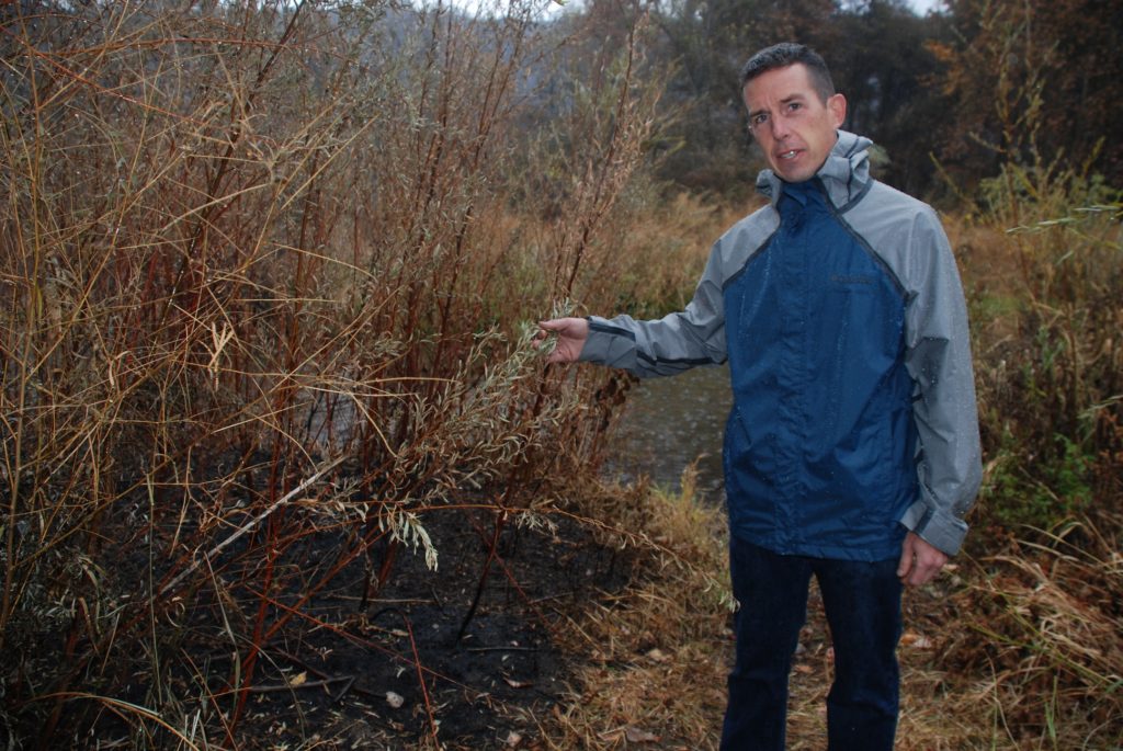
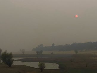
Impacts go beyond the fire itself. As Cal Fire warns in its recent daily update: “Although wildfire damage can be immeasurable, the danger is not over after the flames are put out. Flash flooding and debris flows, structural damage, road instability and damaged trees are just some of the dangers that exist after a wildfire.” Butte County residents, particularly in Butte Creek Canyon, know these aftereffects too well.
Hankins told the CN&R he’s working on a statewide initiative for a comprehensive approach to fire prevention; the effort is so new, it doesn’t have a formal name or standing. It involves other fire experts, including indigenous practitioners of prescribed burning.
Rougle’s agency, the Resource Conservation District, continues to work with agencies such as the Butte County Fire Safe Council on projects like safeguarding evacuation routes and forest health. Since the federal government controls less than 40 percent of county land, aligning what she calls “such a patchwork” of owners remains a challenge.
“We can’t reverse climate change in a gubernatorial administration or several human generations probably,” Rougle said. “We can make decisions that leave future generations with less of a problem. If we dedicated the funds and the political will and the social license, we actually could reverse generations of bad forest management in a couple of gubernatorial administrations. It just takes getting people out in the woods [to do the actual work].”
Correction: A previous version of this story mischaracterized Wolfy Rougle’s quote in the final line and has been changed from “[to see for themselves]” to “[to do the actual work].”
More Camp Fire second anniversary stories:
Vision for Paradise
Burning questions
Be the first to comment