Update (Sept. 9, 7:28 p.m.): During an operational update tonight, Butte County Sheriff Kory Honea announced that three people have died in the Bear Fire. Other than revealing that two of the deceased were found at the same location, he did not release any further details. Additionally, of 85 welfare checks on people within the evacuated areas, 73 have been located and confirmed safe while 12 are still missing.
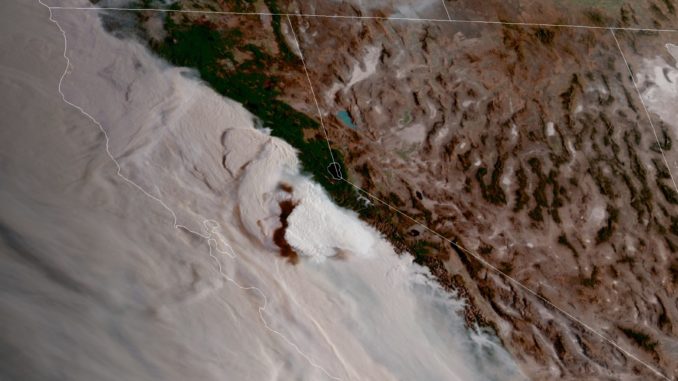
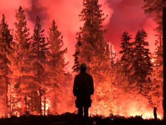
The fast-moving Bear Fire roared into Butte County overnight, reaching the eastern shores of Lake Oroville and into communities from Berry Creek to Oroville East. Fueled by winds of 35 miles per hour, the wildfire spread at rate of 1,000 acres per half hour.
During the U.S. Forest Service’s operation update this morning (Sept. 9), Operations Section Chief Jake Cagle explained that heavy smoke and PG&E’s power outage in the area have stalled mapping efforts. Using satellite projections, however, he estimated that the North Complex Fires (including the Bear Fire) had grown to about 210,000 to 230,000 acres in the last 24 hours, creating a burned area of “about 25 miles across and 30 miles down.” For comparison, the entire Camp Fire burn scar was 153,336 acres.
The fire has jumped Highway 70 to the west in several spots, prompting evacuation warnings for Concow and parts of Paradise (see details below).
There have been no updates at this juncture as to numbers of destroyed structures or possible fatalities, and containment numbers are unknown at this time. Multiple social media posts on Facebook and Twitter report significant damage in the communities of Feather Falls and Berry Creek above Oroville, including cell phone footage of what is reportedly Berry Creek Elementary School fully engulfed in flames.
In Butte County, evacuation orders remain in place for the communities of Berry Creek, Brush Creek, Forbestown, Clipper Mills, Feather Falls, Kelly Ridge and Copley Acres; for residents living east of Miners Ranch Road at Highway 162 and Oro Bangor Highway, which includes Bangor and the Mt. Ida area; and for Cherokee Road at Hwy 70, south to Thompson Flat Cemetery Road, and all areas east to Lake Oroville.
Evacuation warnings also have been issued for the area of Highway 70 from Garden Drive south to Lower Honcut Road, Lower Honcut Road east to Bangor, and everything east to the borders of the current evacuation orders; for the North side of Hwy 70 in the area of Lower Concow; and for Zone 14 in the Town of Paradise.
Evacuation centers are in place at the Gridley Fairgrounds (199 E. Hazel St., Gridley) and Yuba Sutter Fairgrounds (442 Franklin Ave., Yuba City). Animal shelters are set up at Camelot Equestrian Park (for large animals), 1985 Clark Road, Paradise; and Old County Hospital (for small animals), 2279 Del Oro and Mono, Ste. E, Oroville. Call the animal shelter hotline ahead of time at 530- 895-0000.
To donate money for fire-victim relief, visit the North Valley Community Foundation’s Wildfire Relief and Recovery Fund.
Stay up to date on the fires and evacuation orders using the links below:
North Complex fires (including Bear Fire):
https://inciweb.nwcg.gov/incident/6997/
Butte County updates:
Butte County evacuation order/warning map
Butte County Sheriff
Code RED Butte County alert signup
Butte County Sheriff Twitter
Cal Fire Butte Unit/Butte County Fire Twitter
Butte Wx Spotter Facebook page
Plumas County updates:
Plumas County Sheriff Facebook
Code RED Plumas County signup
Yuba County updates:
Yuba County Sheriff Facebook


My neighbor had one of those neighborhood libraries out in her front yard this spring. At some point, she saw it was underused, and she changed it to a neighborhood food library. People volunteer to stock it and keep an eye on it when it gets empty. It has been a thriving part of our neighborhood in Oroville, at Montgomery and First streets. It just seems our neighbor and friends are doing something good for the food- insecure folks.