
")
A CN&R Outdoor Recreation special feature.
If you live in Chico and are looking for some outdoor recreation, nearly any activity you could dream up is just a day trip away. The mountains of Shasta, Lassen and the Sierra Nevada; the lakes of Oroville, Almanor and Tahoe; the Sacramento River; the Pacific Ocean—all of it no more than a 4-hour drive away.
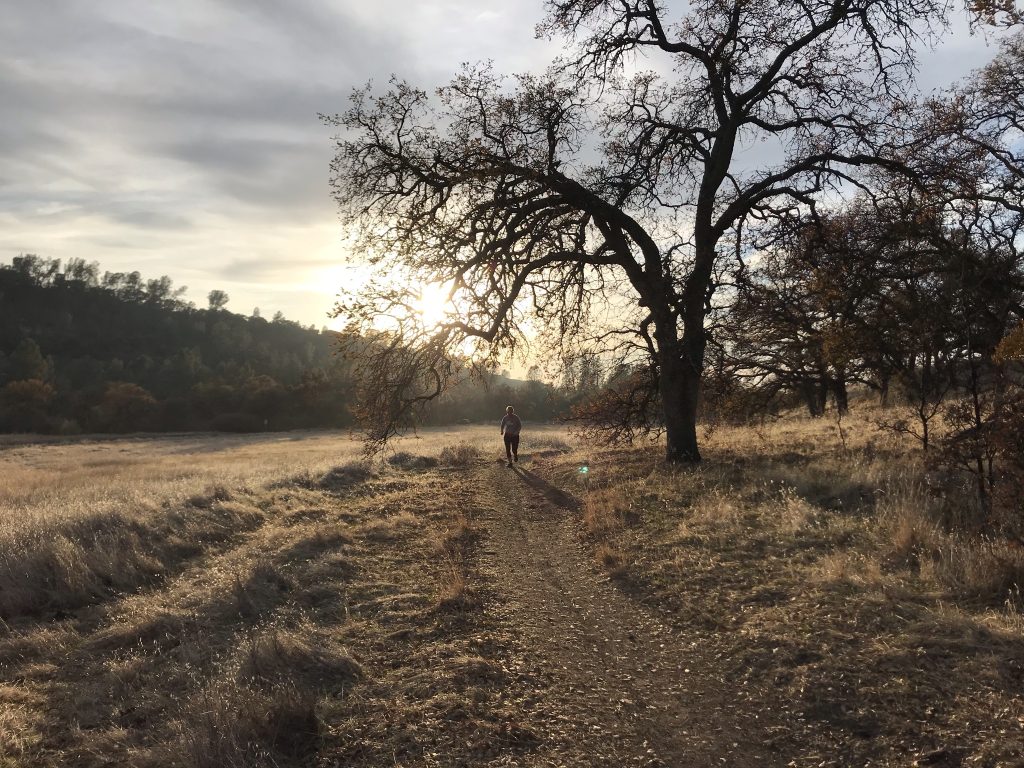
Or just head downtown, where Bidwell Park blooms from the heart of Chico and extends for miles into the Cascade/Sierra foothills. No planning needed. For the cost of getting on your bike or pulling on some hiking shoes, you could stand up, head out the door right now and jump on a trail and explore.
We often hear the boast of the park being 3,670 acres, roughly 11 miles in length, and one of the largest municipal parks in the country (more than three times the size of Golden Gate Park), but most people regularly visit only a fraction of that area. There’s a reason, of course: The smaller Lower and Middle sections boast nearly all of the developed features in Bidwell Park—swimming pools, baseball diamonds, basketball courts, picnic tables, playgrounds, bathrooms, grass—and is situated in a stunning forest providing a protective canopy during the extended valley summers.
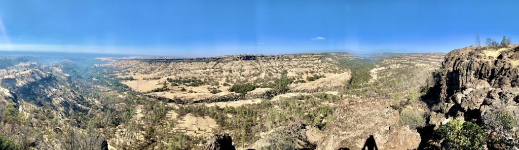
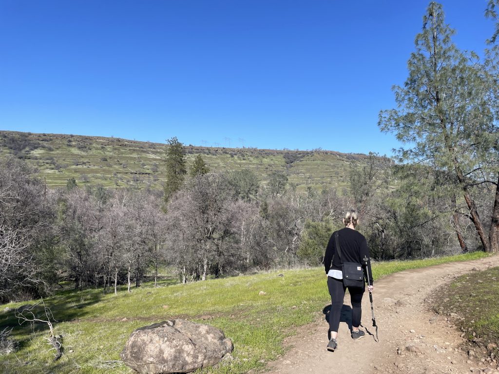
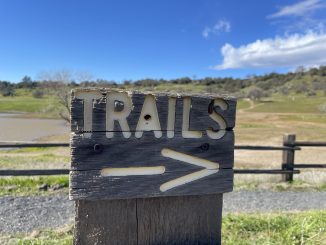
Upper Park is much more rugged, a huge canyon down which Big Chico Creek flows from its origins at Colby Mountain. To deliver you on your hiking, running, mountain-biking, horse-riding adventures, there are 30 miles of sanctioned trails (and just as many miles of bootleg ones) along both the north and south sides of the canyon.
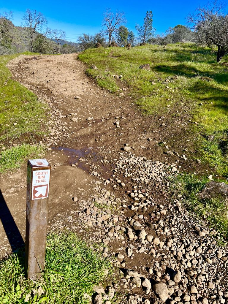
Most of the main trails are clearly marked, but not always. Linda Herman, the city’s Park & Natural Resources Manager, says that “We definitely need more trail signs.” Wayfinding improvements are on her agenda, as are improvements to the parking areas in Upper Park, and rebooting the effort to create comprehensive trail plain, which was paused during the COVID pandemic.
What follows is an introduction to the main routes through Upper Park, but before that, a few things to consider before adventuring:
- Bring a cell phone and, if possible, a friend.
- Dogs are welcome in Upper Park, but they can be off-leash only on the trails on the north side of Upper Park Road.
- Trail etiquette: Bikes make way for people and horses; people make way for horses; horses keep on clopping.
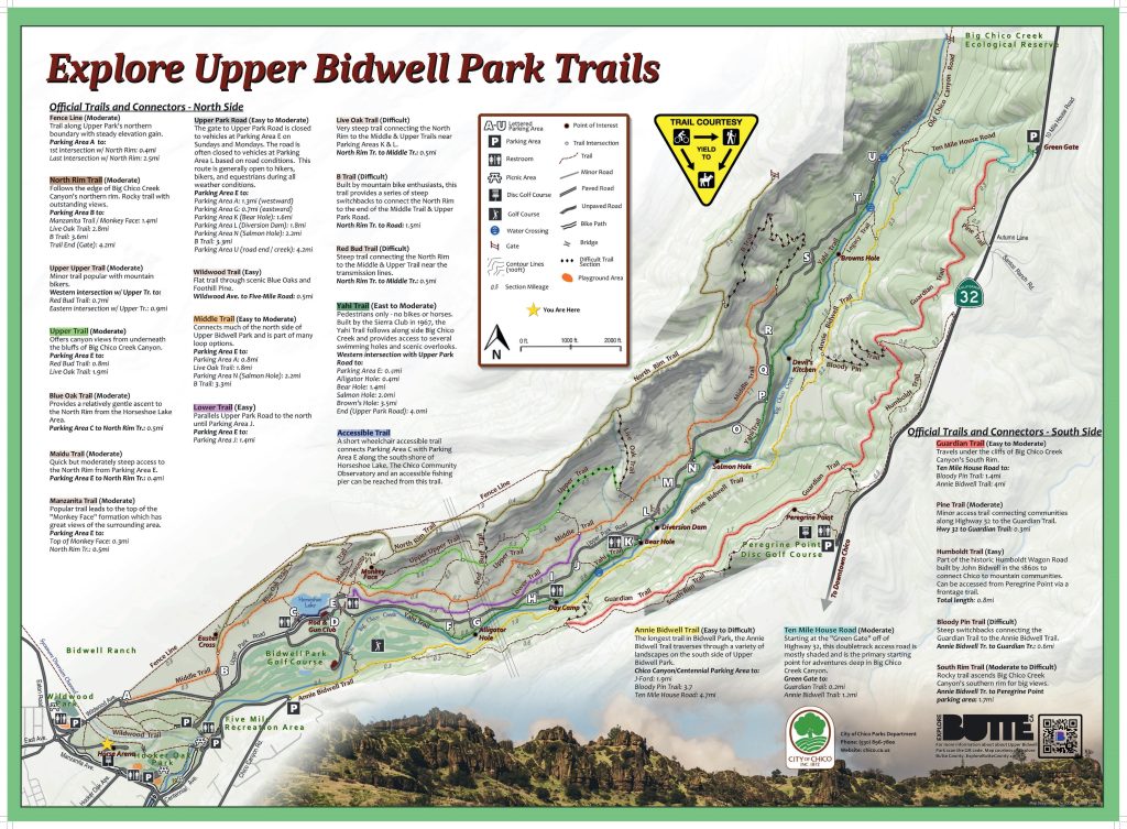
- Pack a map of Upper Park trails. The one below is the latest version. It’s also available online at the city’s website, where you can also get updates on trail status. Trails are closed to bikes and horses after rains, and many park advocates suggest pedestrians voluntarily stay off muddy trails to avoid contributing to erosion.
- Ticks and rattlesnakes: For protection from both, keep to the trails as much as possible. To keep disease-carrying deer ticks off, wear socks and repellent and check yourself and your dogs often. During warm months, the snakes are out, and the City suggests wearing boots, keeping an eye on the trail ahead, and leashing dogs.
- Learn something! Members of park-enthusiast and -advocate groups and local authors have been there before and can provide insight into the many facets of the park:
-Friends of Bidwell Park: friendsofbidwellpark.org
-Chico Hiking Association: chicohiking.org
-Chico Running Club: chicorunningclub.org
-Chico Equestrian Association: chicoequestrianassociation.com
-City of Chico Bidwell Park page: chico.ca.us/bidwell-park
-Nature guides: The Birds of Bidwell Park, The Trees of Bidwell Park, The Wildflowers of Bidwell Park
Upper, Middle, Lower Trails and Upper Park Road
The main road into Upper Park begins at Wildwood Avenue, which turns into Upper Park Road. The paved portion runs through Middle Park and turns into a dirt road at the Horseshoe Lake/Monkey Face parking lot and runs another 4.2 miles, almost to the end of Upper Park along Big Chico Creek. Just past the Diversion Dam parking lot, the road has been closed to motor vehicles for several years due to long-deferred maintenance, but it’s still accessible by foot or bike.
Three trails parallel Upper Park Road to the north—Lower, Middle and Upper. These are the go-to routes for the average trailgoers, frequented by mountain bikers, runners and hikers. The going gets progressively more rugged, and the trails less crowded, as you head up the canyon wall.
Lower and Upper are relatively short, while Middle covers varying terrain over the same rough distance as the main road.
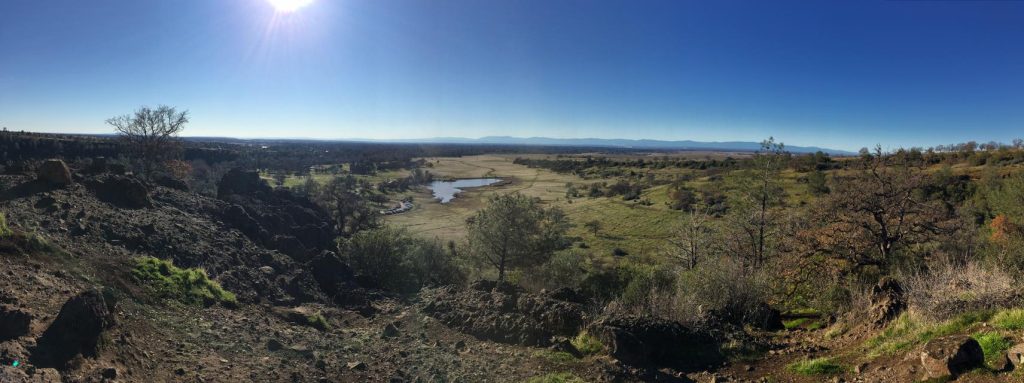
North Rim Trail
North Rim skirts the north edge of Big Chico Creek Canyon along the northwestern boarder of the park, and is one of the more popular Upper Park trails, with its convenient trailhead at Parking Lot B just below the Easter Cross. There are a few short (and often very rugged) trails that descend from the North Rim, including the far out B Trail, which offers a challenging descent for mountain bikers.
From the trailhead, North Rim is uphill all the way, starting at 304 feet elevation and continuing to 1,398 feet over the course of 4.5 miles. Within a half mile, the climb pays off with stunning views of Chico, the valley and the Coastal Range.
The North Rim Trail features the widest trail in Upper Park. It’s a bumpy ride over exposed rocks, but the space offers ample room for people, bikes and dogs as well as a wide view of potential hazards ahead—namely rattlesnakes.
Yahi Trail
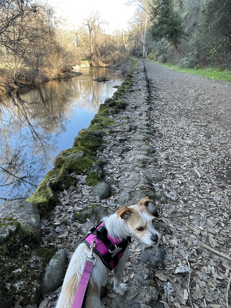
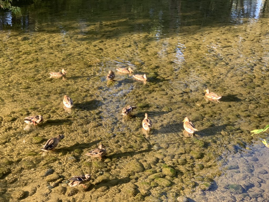
Yahi is a pedestrians-only trail (no bikes or horses) that starts near the beginning of the dirt section of Upper Park Road and runs along the north side of Big Chico Creek. Constructed in 1967 by the local Yahi Group of the Sierra Club, the path is notable for its lush, shady greenery and access to numerous picturesque spots and swimming holes along the creek.
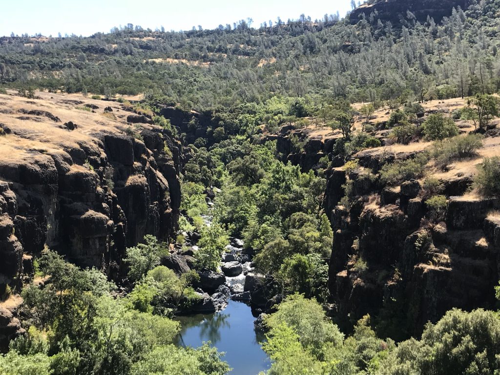
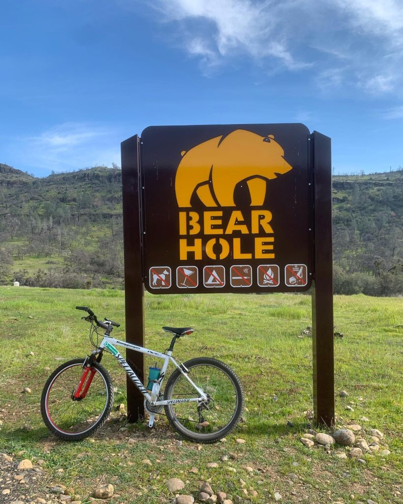
It’s two miles out to Bear Hole and the Diversion Dam, which features some of the best—and most popular—swimming spots on the creek. This is where most folks turn back after a cooling dip, but it’s only the halfway point. There are another couple miles of Yahi and some of the best features of the park, including a spectacular view of the bend of the creek at Salmon Hole from atop the canyon; a turkey vulture lookout; and an up close look at the impressive lovejoy basalt formations in Iron Canyon (e.g., the black spires of Devil’s Kitchen).
Annie Bidwell Trail
The Annie Bidwell Trail is reminiscent of the Yahi. Similarly, it runs close to Big Chico Creek—only on the opposite shore—and follows the water through the lower part of the canyon. It’s more rugged (i.e., “difficult”) in spots, and has fewer creek access points, but it too provides a measure of shady respite from the summer heat.
In the spring, the meadow flowers as you approach Bear Hole can be spectacular, and further on the views over Iron Canyon are jaw-dropping. One big difference: Annie B. is not pedestrian-only like the Yahi, and mountain bikers and hikers/runners share the trail in equal numbers.
During low-water season, a fun option for a long hike (roughly 10 miles) is to take either Yahi or Annie B. out, cross the creek below Ten Mile House Road (or Parking Lot U on the Yahi side), and then head back via the other.
The trailhead for Annie B. is just beyond the Five-Mile Recreation Area, where Centennial Drive meets Chico Canyon Road. This is also the starting point for those continuing on to South Rim and Guardian trails.
Guardian Trail
Out here there be mountain bikers. High up the south canyon wall the Guardian Trail provides challenging riding and panoramic views of Upper Bidwell Park. There are many ways to attack it, with a popular option starting at the Green Gate entrance to the park (on Hwy 32, about 8 miles east of Hwy 99) and doing an 8.6 mile loop down Guardian to South Rim Trail (at a junction that also includes a steep side trail leading down to Annie Bidwell Trail) and back.
This Guardian and South Rim (plus Annie B.) system is great for hikers and runners as well, featuring many ups and downs that can easily add up to more than 1,000 leg-burning feet of elevation gain.


Be the first to comment