
Photo by Ashiah Scharaga
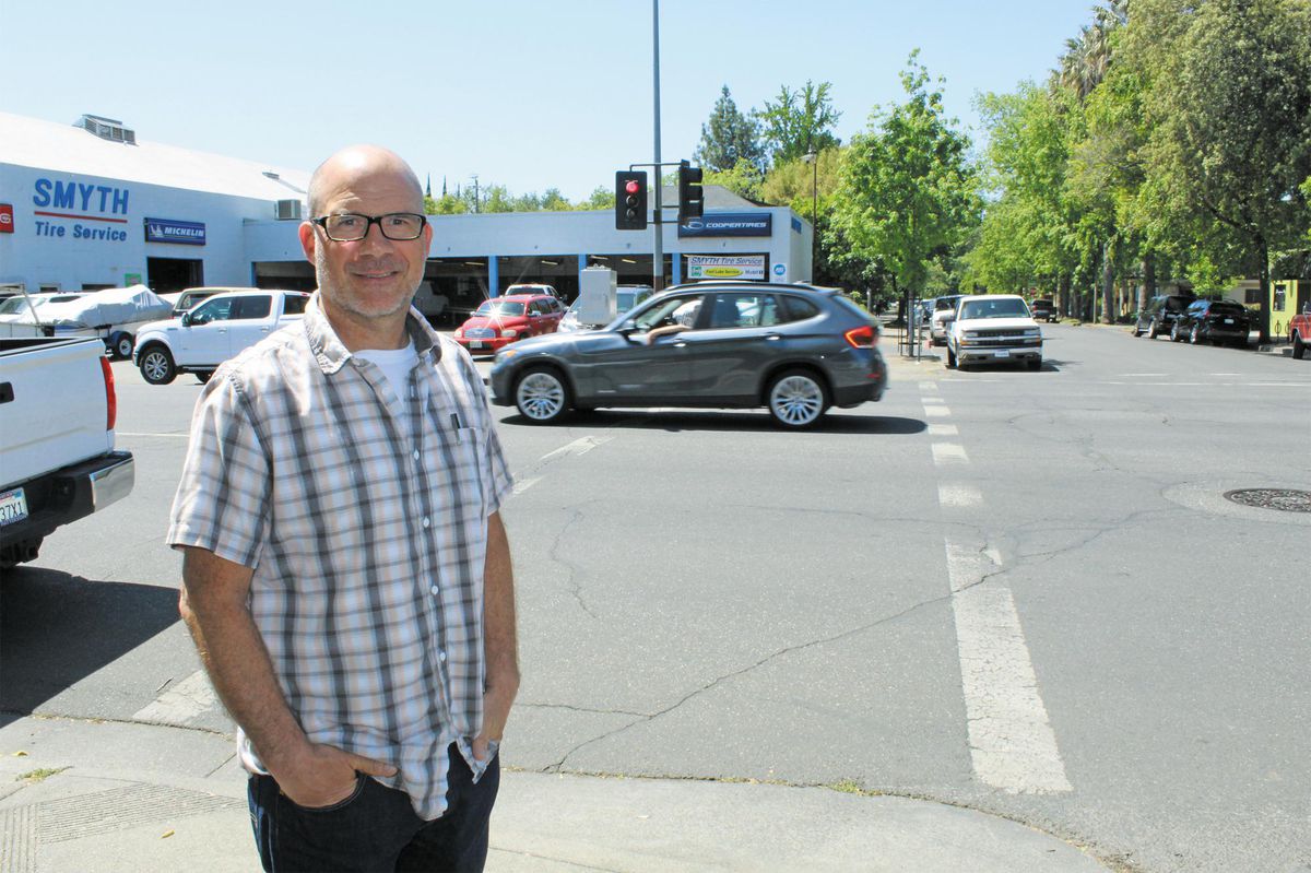
Jeff Schwein sees Broadway Street as a roadway in the city that could benefit from protected bike lanes.
A month after the Camp Fire, city staff set up 34 traffic counters across Chico to determine average daily traffic volumes. Using data from the same locations collected a year prior, they were able to compare that with December 2018.
The results? An overall 25 percent increase. In some parts of the city, the impact was much less, as low as 4 percent on East Avenue. But on other roadways, traffic surged greatly—by as much as 77 percent on East 20th Street and 63 percent on Eaton Road.
That represents a 15- to 20-year projected increase in traffic volumes essentially overnight, said Brendan Ottoboni, city public works director of engineering.
The question now is whether that trend has continued. The traffic counters, which collect data as cars drive over thin black tubes, were set up in the same locations last month, and Ottoboni anticipates updating the numbers every six months.
The best practice for such an increase is to widen the roads, Ottoboni told the CN&R, which would improve safety and decrease congestion. “But we realize that takes a long time and a lot of money,” he said.
That’s why Ottoboni is hoping to receive funding from the state and federal government—the California Office of Emergency Services (CalOES) and Federal Emergency Management Agency (FEMA)—to pay for projects that would help address this massive increase in traffic directly related to the disaster.
One such improvement is an intelligent transportation system, which would create a connected wireless network between all the traffic signals within the city. The city could then manage signal timing from a computer within City Hall in a matter of minutes, rather than the hours it takes to manually reprogram each traffic signal.
“It becomes an adaptive network,” Ottoboni explained, “so it responds to traffic demands to improve circulation at intersections so you’re not getting as much delay and backup.”
The price tag for that system isn’t cheap—$12 million—but Ottoboni said it beats construction costs. That same amount of money would widen 2 miles of road, tops.
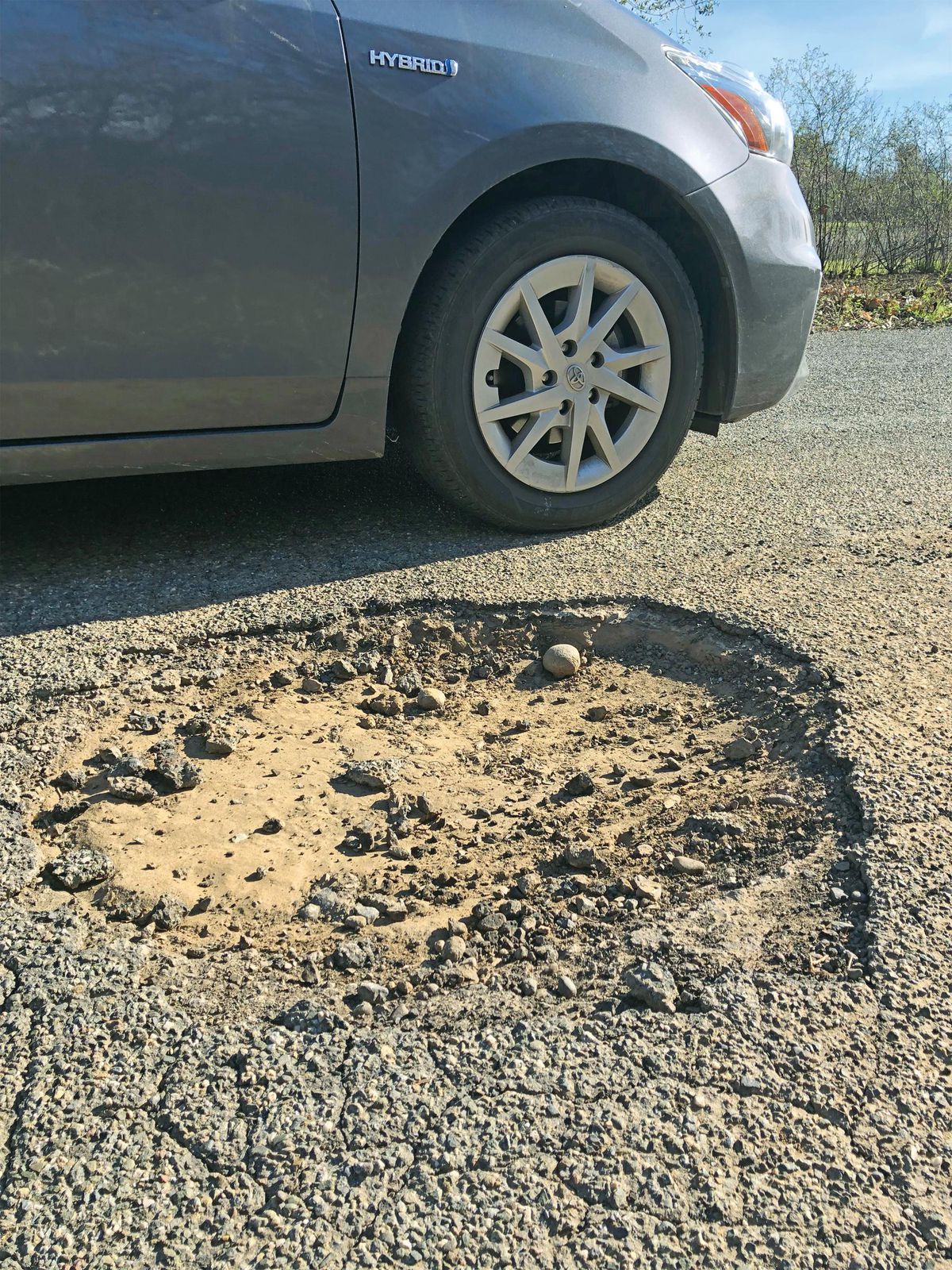
Photo by Melissa Daugherty
The most recent pavement condition index rates 43 percent of Chico’s roads as poor. Pictured here is a mega pothole on Centennial Avenue near Upper Bidwell Park.
For private transportation planner Jeff Schwein, the solution to thinning traffic on Chico’s crowded roadways is simple: Build more bike paths.
Take Broadway and Main streets in downtown Chico, for example. Remove a lane and reserve it for bicyclists, Schwein suggested, and widen the sidewalks for pedestrians to accommodate more people during downtown’s busy weekly events and more restaurant patio seating.
Schwein supported “radical” solutions like this before the Camp Fire—he owns Green DOT Transportation Services, a firm that focuses on creating infrastructure that incentivizes people to walk, bike or ride public transit, rather than drive.
But he thinks this out-of-the-box, nonautocentric perspective has taken on urgency since the city took in approximately 19,000 more people.
“Chico is perfectly positioned for a whole new paradigm for mobility,” Schwein said. “If you build the facilities to cater to those alternative modes of transportation, and make it convenient and enjoyable and comfortable, maybe there’s a nexus for improving everything about Chico: the congestion relief, the quality of life, the health and the social interaction.”
It’ll take a while to determine exactly how the city’s roadways have been impacted, Ottoboni said—it depends on how long the increased traffic is sustained, as well as how many of those trips are from heavy trucks. Typically, 5 percent of trips can be attributed to such vehicles, Ottoboni said. His staff is estimating that number is as high as 30 percent for some areas of the city, like the Skyway, because of debris removal operations on the Ridge.
“What we’ve been trying to communicate [to CalOES and FEMA] is … when you add it all up, they’re big impacts, and it causes congestion … it causes additional traffic collisions. Those are statistically driven facts.”
The city’s list of infrastructure project priorities hasn’t changed. The wildfire “just exacerbated the problem” along those more heavily trafficked corridors, Ottoboni said. A Bruce Road widening and bike lane project continues to be the No. 1 priority in terms of “capacity-enhancing projects.”
Other priority roadways include East 20th Street, Eaton Road and the Midway.
But, like other departments within the city, Ottoboni’s team has been overwhelmed with work. A reconstruction of The Esplanade from Lindo Channel to East Avenue, for example, was supposed to start this summer. It’s been delayed until next year because of the additional work load from the Camp Fire.
Construction engineering company Harris & Associates is working with the city on recalculating its pavement condition index, which was last updated in 2015. Based on that report, staff estimates that 43 percent of the city’s roads are in poor or very poor condition. It indicated the city would need a $7 million annual budget just to maintain its roads; $10 million to actually improve them. About $3 million is currently budgeted, factoring in gas tax funds and waste-hauling franchise fees.
“You could throw a dart at the wall and you’re not going to miss. There are so many roads out there that need to be fixed,” Ottoboni said. “Due to the lack of funding over a very long period of time, those deferred items of preventative maintenance are now becoming more costly repairs.”